- Printed on Tyvek® (synthetic)
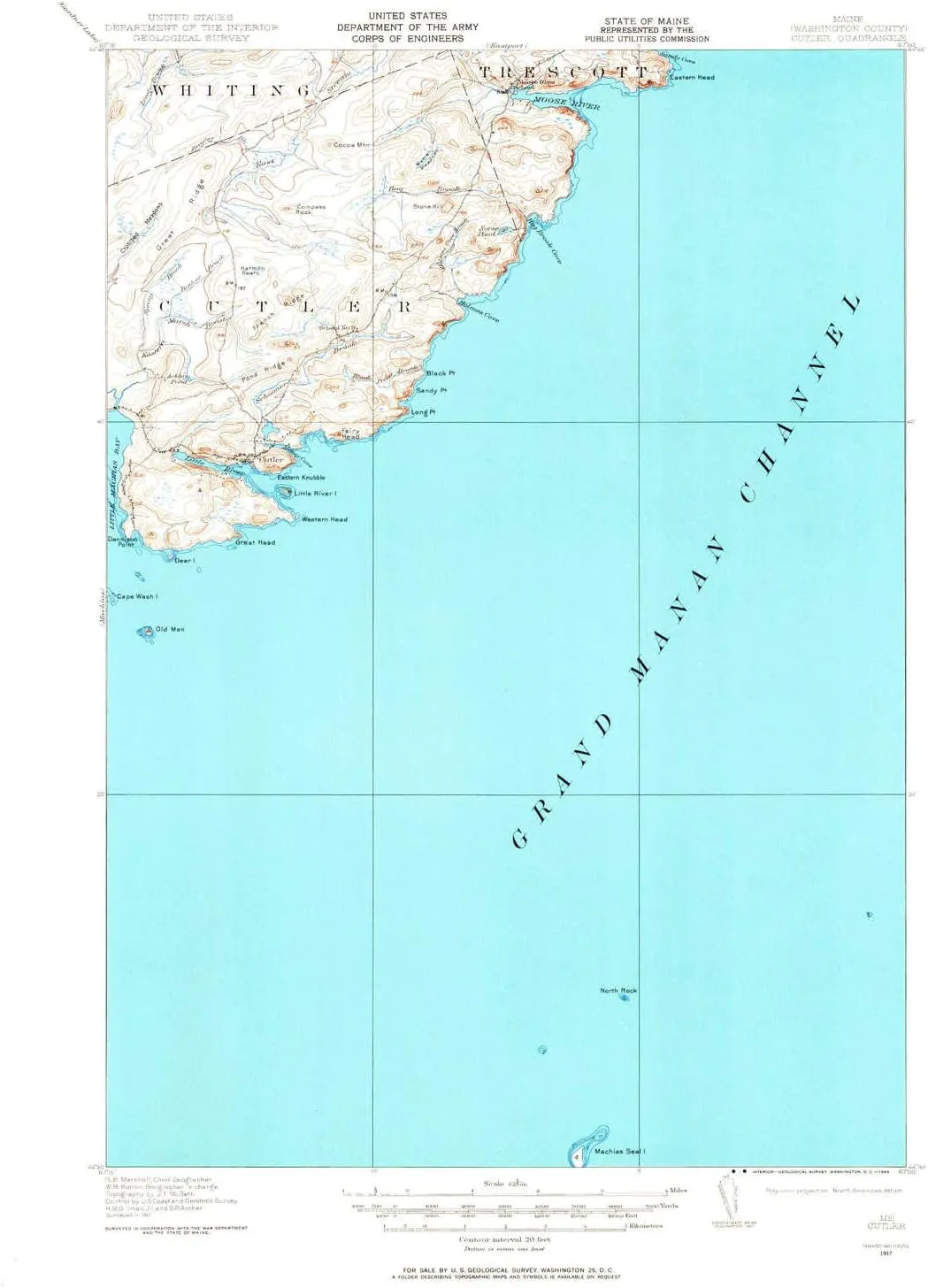
- USGS topographic map of Cutler, ME, at 1:62500 scale. Lighter material. Waterproof. Tear-resistant. Foldable. Very durable. Perfect for backpacking and the outdoors.
- Cities, towns, villages: Cutler,Little Machias
- Mountains: Compass Rock,Eastern Knubble,Eastern Head,Stone Hill,Cocoa Mountain
- Valleys: Low elevation topographic features such as flatlands, river valleys, and canyons.
USGS topographic map of Cutler, Maine, dated 1917, updated 1965.
Includes geographic coordinates (latitude and longitude), lines of elevation, bodies of water, roads, and more. This topo quad is suitable for recreational, outdoor uses, office applications, or wall map framing.
Printed on-demand by YellowMaps on the print material of your choice.
Shipping rolled from Minneapolis, MN, United States.
Product Number: USGS-5684103
Map Size: 20.8 inches high x 16.9 inches wide
Map Scale: 1:62500
Map Type: POD USGS Topographic Map
Map Series: HTMC
Map Version: Historical
Cell ID: 53164
Scan ID: 460340
Imprint Year: 1965
Survey Year: 1917
Datum: NAD
Map Projection: Polyconic
Map published by United States Geological Survey
Map published by United States Army Corps of Engineers
Map Language: English
Scanner Resolution: 600 dpi
Map Cell Name: Cutler
Grid size: 15 X 15 Minute
Date on map: 1917
Geographical region: Maine, United States
Northern map edge Latitude: 44.75°
Southern map edge Latitude: 44.5°
Western map edge Longitude: -67.25°
Eastern map edge Longitude: -67°
Surrounding map sheets (copy & paste the Product No. in the search bar):
North: USGS-5535779,USGS-5684175,USGS-5637957,USGS-5684171,USGS-5637963
East: USGS-5537353,USGS-5537355
South:
West: USGS-5536723,USGS-5684605,USGS-5536721,USGS-5684603,USGS-5536725


")


")
